- Have Any Question?
- 443-983-5232
- info@moosepondassociation.org
Stabilizing the Moose Pond Watershed
- Home
- Stabilizing the Moose Pond Watershed

Project Details
- Category : Watershed
- Date : Fall 2013
- Status : Completed
- Tags : Water, Environment, Watershed
- Live demo :
- 15 Oct 2013
- Watershed
Stabilizing the Moose Pond Watershed
Every little bit helps. Every bit of phosphorus kept out of the water helps the lake’s health. Every waterfront erosion problem fixed keeps more phosphorus out of the lake. To find the places where excess phosphorus is entering the lake, properties on Moose Pond were surveyed.
In 2010, the Moose Pond Association, in conjunction with Lakes Environmental Association and Cumberland County Soil and Water Conservation District (CCSWCD) conducted a watershed survey. A watershed survey is a volunteer effort to identify sites of runoff and erosion.
Ten teams were trained by Heather True, project manager of CCSWCD and Wendy Garland, grant administrator for the Maine Department of Environmental Protection. The goal was to identify sources of erosion, e.g. exposed roots and stones, road ruts, bare soil, accumulated or transported sediment and deltas in the pond. For the most part, teams spent less than fifteen minutes at a site, noted roof run-off and any other problems, identified the site on a tax map, took photos and GPS readings, wrote a brief description of any problems and described the fixes.
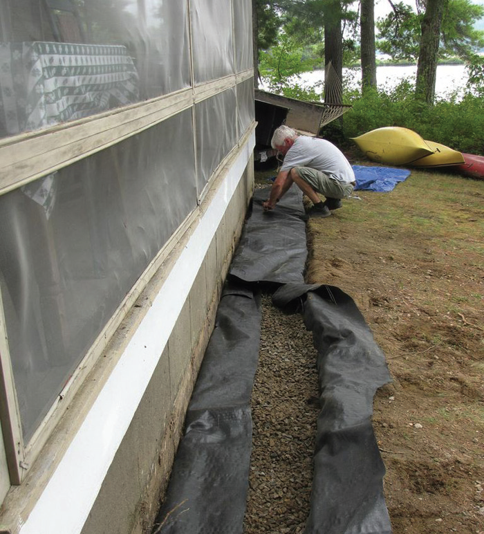
Fixes include directing runoff to stable vegetation by creating meandering footpaths to the pond, installing a drip edge trench along the drip line of a house without a gutter, using a rain barrel to capture water, planting vegetated buffers, crowning a road or driveway, installing runoff diverters such as rubber razors or open-top culverts, etc.

This watershed survey was not a finger-pointing experience. Instead, it was meant to be an overall review of the area with the common goal of preserving long-term water quality. Once the survey was completed, MPA and LEA worked with the DEP to seek funding from Grant Section 319 of the Clean Water Act to fix high impact sites. The high impact sites included Winona Camps, Mountain Road and Cedar Drive.
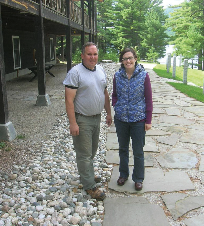
The work at Winona focused on the runoff coming from the Junior Wiggy building toward the Kearns Amphitheater. Director Spencer Ordway explained that they worked with a landscape architect to better handle water running off of the large roof. At the drip line, perforated drains were installed in a trench up to seven feet deep in places, covered with crushed stone to cause the roof runoff to infiltrate in the ground before reaching the lake. The drains also directed excess runoff away from Moose Pond. The new drainage plan was carried out by Warren Excavation using a variety of landscape cloth, hay mats, erosion control mulch and other materials. Besides stabilizing this area, a section of shoreline near the camp’s “Round House” was also improved with hay mats and stone. Before completing the terracing and stone retaining wall, bare roots of ancient pine trees were exposed.
Taking care of these erosion problems and doing their part to maintain the water quality of the lake is important to the Ordway family. “The whole Winona experience relies on the symbiotic relationship with Moose Pond and the natural surroundings. If we were not able to swim and boat and play in Moose Pond, I’m not sure where Winona would be,” Ordway said.
They continue to work on other sections of their shorefront to minimize erosion, while also upgrading camp roads to handle the heavy rains that have fallen in recent years.
Further south on Moose Pond, Steve Sudduth, a director at Wyonegonic Camps, said that over the past 15 years they have installed silt collection pools and catch basins to handle runoff from roads and especially from large roofs near the lake. This fall, they are working to re-grade a parking lot so runoff has more space to absorb before reaching Moose Pond.
At the East Area of Shawnee Peak, erosion problems in the parking area were addressed with help from the CCSWCD field engineer, said General Manager Ed Rock. The work involved improving ditching and culverts so water is filtered before arriving at the ditches on the uphill side of Mountain Road.
“We spend a lot of time and energy on erosion control at the mountain,” Rock said. “If we have ruts from erosion, it causes us to have to make more snow to cover up the rougher terrain, which costs us more time and money.”
During the summer, the crew maintains culverts and water bars on the trails so that water is directed into the woods to disperse before it flows downhill toward the road and lake. “We want to be good stewards of Moose Pond, it is a huge asset to the entire area,” Rock said.
Heavy rains on Mountain Road have caused washouts over the last few years. In response, the public works departments from both Bridgton and Denmark have stabilized areas alongside the road. At one particular gully, water was cascading around a boulder, washing out the road and continuing on to a tributary stream. The area has been stabilized with rocks. Also, new gravel and sloped ditches improved the erosion and pooling situation on Cedar Drive, located adjacent to the upper basin of the pond.
All residential landowners were also given the opportunity to apply for matching grants. These sites are small, but the cumulative impact affects the pond’s water. A few remaining funds are available, but the work must be completed by the end of 2013. If you are interested in technical assistance, contact Heather True at htrue@ cumberlandswcd.org. It’s important to remember that permitting is needed to stabilize any site.
Moose Pond covers a surface area of 1,617 acres, while its watershed includes 11,170 acres. Healthy watersheds are the main goal for a healthy environment and economy. Phosphorus is an important nutrient that occurs naturally throughout the environment. Excess phosphorus in aquatic systems, however, can lead to over-fertilization in the pond and result in an algal bloom, which can deplete oxygen from the water through the decaying process. As water quality declines and habitat is damaged, lakefront property values decline, affecting individuals landowners and the economics of the entire community.
Developed watersheds mean vegetation has been removed and the land smoothed out for homes, lawns, driveways and roads. Five to ten times more phosphorus comes from developed watersheds. In contrast, forested watersheds filter storm water naturally through pine needles, leaves and other vegetated buffers that slow runoff.
The Moose Pond Association strongly encourages water quality protection practices implemented on the landscape that can reduce or eliminate overland runoff water.
