BACKGROUND
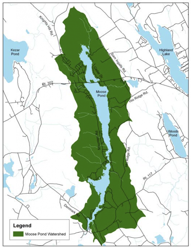
The Moose Pond Watershed is located in the towns of Bridgton, Denmark, and Sweden in both Oxford and Cumberland County and has a drainage area of 11,170 acres.
According to the Maine Department of Environmental Protection, Moose Pond has been degraded by polluted runoff in the form of soil erosion, which is the greatest threat to water quality in Maine. WHY?
- Soil contains the nutrient phosphorus, which has the potential to promote algae blooms when it enters a lake in large quantities. As the algae die off, the water becomes depleted of oxygen through the breakdown process, and fish and animals are unable to survive.
- Algal blooms also turn the water green and murky, make rocks slippery, and give water an unpleasant taste and odor.
- Studies have shown that as water clarity decreases, property values also drop. Decreased water clarity can also be highly detrimental to tourism.
A watershed is all of the land surrounding a waterbody that drains, or sheds, its water into the resource through streams, ditches, over the ground or through the groundwater.

WATERSHED SURVEY:
On May 5th, 2010, through collaboration efforts of Cumberland County Soil and Water Conservation District, Lakes Environmental Association, and the Moose Pond Association, teams of 32 local volunteers and technical staff conducted a survey of the watershed and identified 208 sites that are contributing polluted runoff to Moose Pond.
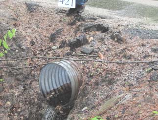
Teams documented polluted runoff from roads, properties, driveways, and trails using cameras and standardized data sheets. Sites were ranked based on their impact to the pond and the estimated cost to fix the site. Conservation practices were also recommended for each site.
Results were compiled into the Moose Pond Watershed Survey Report,
which can be viewed online at www.cumberlandswcd.org.

KEY SURVEY RESULTS:
Volunteers and technical staff identified 208 sites in the Moose Pond Watershed that are impacting or have the potential to impact water quality.
- Out of the 208 sites identified, 23 were rated as having a high impact to water quality, 75 as medium impact, and 110 as low impact.
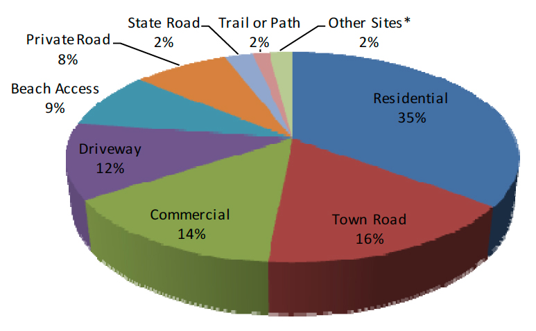
- Impacts predominantly consisted of the following land uses: residential, town roads, commercial, driveways, beach access, and private roads.
- Residential and driveway sites combined represented more than half of all the sites.
SUMMARY OF LAND USES AND IMPACTS
| Land Use | High Impact | Medium Impact | Low Impact | Total |
|---|---|---|---|---|
| Beach Access | 0 | 9 | 9 | 18 |
| Boat Access | 2 | 0 | 0 | 2 |
| Commercial | 8 | 12 | 10 | 30 |
| Construction Site | 0 | 1 | 0 | 1 |
| Driveway | 2 | 4 | 18 | 24 |
| Picnic Site | 0 | 0 | 1 | 1 |
| Private Road | 2 | 7 | 8 | 17 |
| Residential | 3 | 26 | 44 | 73 |
| State Road | 1 | 3 | 1 | 5 |
| Town Road | 5 | 11 | 18 | 34 |
| Trail or Path | 0 | 2 | 1 | 3 |
| Total | 23 | 75 | 110 | 208 |
Percentages of Erosion Sites by Land Use

and Picnic Site (1 site)
NEXT STEPS:
- As it is the cumulative impact of all erosion sites (large and small), fixing the sites identified in the survey will require efforts by a variety of stakeholders: individual landowners, Moose Pond Association (MPA), private road associations, and municipal officials. MPA will be contacting all landowners identified in the survey to inform them about observations made and voluntary assistance available.
- Cumberland County SWCD will be applying for grant funds to assist landowners, road associations, and towns in the installation of conservation practices to address the identified erosion problems. We will know if the grant has been received in August of 2011, and work will begin in January 2012.
- If you have an identified erosion problem on your property or would like to receive a copy of the report, please contact Cumberland County SWCD at 892-4700.
WHERE TO GO FOR MORE INFORMATION
Cumberland County Soil & Water Conservation District
| 35 Main Street, Suite 3, Windham, ME 04062 | (207) 892-4700 | www.cumberlandswcd.org |
Lakes Environmental Association
| 230 Main Street, Bridgton, ME 04009 | (207) 647-8580 | www.mainelakes.org |
Moose Pond Association
| PO Box 647, Bridgton, ME 04009 | www.moosepondassociation.org |
Maine Department of Environmental Protection
| 312 Canco Road, Portland, ME 04103 | (207) 822-6300 | www.mainedep.com |
The Moose Pond Watershed Survey was funded in part by the US Environmental Protection Agency (EPA) under Section 319 of the Clean Water Act. Section 319 grants are administered by the Maine Department of Environmental Protection in partnership with EPA in order to prevent or reduce water pollution in Maine.
All programs and services of the Cumberland County Soil & Water Conservation District are offered on a non-discriminatory basis, without regard to race, ethnicity, color, gender, religion, age, disability, political belief, sexual orientation, or marital or family status.

